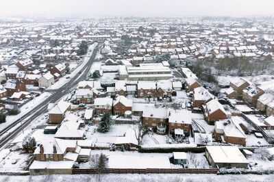
The UK could be battered by 30 hours of snow and blizzard-like conditions next week, according to new weather maps, which show swathes of the country turning white as freezing air sweeps south. It comes with the Met Office naming where snow will hit England next week in a new forecast
Weather maps from WXCharts indicate snowfall is expected to begin around 6am on March 24, before intensifying through the day and continuing overnight - with wintry showers lingering until around 12pm on March 25. The latest ECMWF weather model maps pinpoint up to 18 major UK cities that could see snowfall, with Scotland facing the heaviest accumulations as temperatures plunge well below seasonal norms. Maps show snow depths of 8cm to 14cm possible across parts of Scotland, particularly in the Highlands and areas north of Glasgow, Dundee and Aberdeen. Elsewhere, a broad band of lighter snowfall is forecast to spread south across Northern England including Northern England, the Midlands, Wales, parts of the South West Eastern England, the South Coast and even parts of London and surrounding areas.
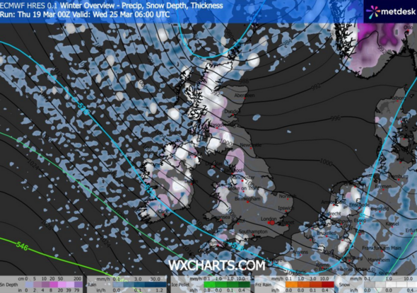
The maps suggest the main snow event will last for around 30 hours, beginning early Monday morning and gradually easing from the south by Tuesday lunchtime.
Northern areas may continue to see wintry flurries into the afternoon.
Motorists and commuters are being urged to monitor forecasts closely as conditions could change rapidly.
The cold snap is set to arrive around the official start of spring, bringing a final blast of winter weather to large parts of the UK.
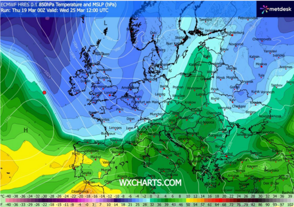
Temperatures high up in the atmosphere are forecast to plunge to between -6C and -8C across much of the UK, with even colder air close to -10C possible in parts of northern Scotland.
On the ground, conditions are set to feel bitterly cold, with daytime highs struggling to get above 2C to 4C in many areas. Overnight, temperatures could fall close to freezing - or slightly below - especially in rural spots.
Forecasters say the mix of freezing air and bursts of precipitation could lead to slushy snow settling in places, icy roads and potential travel disruption, particularly during busy morning rush hours.
Weather charts also show a deep area of low pressure moving close to the UK, dragging cold northerly air southwards and helping to trigger widespread wintry showers.
This setup raises the risk of short-lived blizzard-like bursts, especially over higher ground in Scotland and northern England where stronger winds could combine with heavier snowfall.
London
Birmingham
Manchester
Liverpool / Blackpool area
Newcastle
Glasgow
Dundee
Aberdeen
Belfast
Dublin
Cardiff
Swansea
Bristol
Plymouth
Southampton
Norwich
Ipswich
Stoke-on-Trent
Contact to : xlf550402@gmail.com
Copyright © boyuanhulian 2020 - 2023. All Right Reserved.